Using AI to control energy for indoor agriculture
30 September 2024
Published online 28 February 2017
Geophysics and geoarchaeology uncovers sacred landscape of the Nile.
© Meredith Brand
Archaeologist Angus Graham of the Uppsala University, Sweden and his international team are teaming up to reconstruct the ancient waterscapes in Luxor, Egypt, with Karnak temple dedicated to Amun-Ra on the east bank and the Valley of the Kings and the pharaohs’ massive mortuary temples on the West Bank. He says their quest to decode the ancient environment is trying to establish whether the Egyptians were digging canals from the river to a basin in front of the temple as part of the connection between the temple and the broader landscape.
With the benefit of geophysics and geoarchaeology, archaeologists are better equipped to recreate the history of the Nile, its migration, and the ways in which ancient Egyptians managed this vital resource.
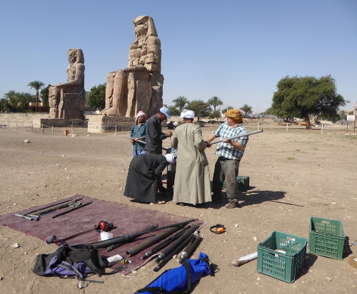
Graham combines geoarchaeology and geophysics to survey the 7,500 hectare-plus West and East Bank floodplains including Karnak temple.
His geoarchaeology team drills 70mm diameter cores deep into the floodplain in order to construct a sedimentary profile – boreholes are drilled at a maximum spacing of 250m along transects extending over 3km from the desert edge to the current west bank of the Nile. These core samples reveal sedimentary changes that relate the movement of the river and gradual build up of floodplain.
As Graham explains, “We look at grain size and how well the sediment is sorted, so if it is really well-sorted then it is probably laid by the river because water sorts the sediment size, but if it’s really badly sorted, then it’s probably humans.”
Through thousands of core samples, Graham’s team have found “packages of sediment from the same process of deposition” - or facies. The project aims to join the sedimentary record from all the boreholes to create a three-dimensional map showing the location and the migration of the river and canals.
The geophysical team uses Electrical Resistivity Tomography (ERT) with probes that send a weak electrical current into the ground to measure resistance.
ERT profiles complement the borehole data to reveal the presence of ancient river channels. “Sands and archaeological material have high resistance readings, whereas the Nile silts, [which are] the suspended sediments from the Ethiopian highlands have a very low resistance reading,” Graham says. “So we can see those really clearly.”
Graham and Judith Bunbury’s hand augering in the Karnak temple, the largest in ancient Egypt and the home of the god Amun-Ra uncovered changes in sediment composition, revealing that the temple was founded on an alluvial island formed in the middle of river 4,200 to 4,300 years ago. Then, according to Graham, the island stabilized sometime around the end of the Old Kingdom (c. 2686 – 2160 BCE) and shortly after, the Egyptian kings started their construction efforts.
In ancient Egyptian mythology, the creator god rose from the waters of chaos on a primeval mound in an event that - in theory – the temple location sought to replicate. Graham’s finding is crucial because it shows that the ancient Egyptians, did as their texts outlined and tried to reproduce the origin of the universe in the landscape by putting their temple on the primeval mound.
Graham and his team have identified a silted-up Nile channel running close to the New Kingdom king’s (c. 1550-1069 BCE) mortuary temples. This secondary channel passed in front of Kom el-Hetan – Amenhotep III’s (c. 1300 – 1352 BCE) mortuary temple fronted by the famous Colossi of Memnon statues. Such a channel, “would help enormously to deliver those statues to the temple, 720 tons each from Kom el-Ahmar near Cairo,” Graham suggests.
Graham’s ERT readings from inside Kom el-Hetan shows material of high resistivity, suggesting huge amounts of underground rubble. Graham recalls, “I nearly fell off the box, it was the Eureka moment – we’ve got a canal running right through the middle of the temple.” However, as he explains, the bottom of the canal is at the exact level as the floor of the temple, which shows that it had been cut long after the reign of Amenhotep III when the temple had been covered by inundation silts.
The project’s ability to answer big questions with geophysics and geoarchaeology hinges on assigning a date to the sedimentary record. “One of the issues that we would really quite like to overcome is the issue of chronology,” says Graham.
In the floodplain close to the temple complexes many ceramic fragments are found in the boreholes, which are of some use in dating the facies. But, Graham says, this method is not ideal as “the shards are often very small, maybe only 4, 5, or 6 mm in diameter, and they are often very badly eroded,” making them difficult to date.
Geoarchaeologists can more effectively date sediments using optically-stimulated luminescence (OSL) that measures ionizing radiation and reveals the date sediments were last exposed to sunlight.
Due to government regulations, it is difficult to export sediment samples out of the country and there aren’t any OSL labs in Egypt, according to Graham.
If it were possible to export ‘sterile’ samples or develop protocols in Egyptian labs, Graham comments, “it would make a huge difference to our understanding and allow projects in Egypt to join other archaeological projects around the world employing the latest scientific techniques.”
doi:10.1038/nmiddleeast.2017.39
30 September 2024
23 September 2024
11 September 2024
Sign-up to receive our e-alert update every two weeks to keep up with everything new on the portal.
Sign up for e-alerts
Stay connected: